
Statesville Neighbor Block Sources
Public sources describe different layers around a Statesville address. The tax card ties a parcel to an owner display and deed reference. MapGeo shows the parcel’s shape and selected county layers. A directory places a printed household on a street in a particular year, while a Sanborn sheet records a structure and use. These tools place nearby parcels in time and geography. None supplies a complete roster of people on a block.
| Source | Block signal | Best access |
|---|---|---|
| Iredell parcel card | Parcel, owner display, situs address, deed, values, sales, zoning | Tax Search public view |
| MapGeo and county maps | Parcel geometry, roads, ZIP, ward, precinct, township, selected layers | Map viewer and Map Gallery |
| Recorded deed or plat | Parties, legal description, book or page, boundary language | Register of Deeds and office route |
| City directories | Dated street-to-household or reverse-directory clues | Library and DigitalNC |
| Sanborn and local maps | Buildings, mapped use, street form, and physical change | Library or Library of Congress |
Start with the current address, but record whether a source says owner, grantee, household entry, or another role. An owner can be a trust, corporation, executor, or person who does not live at the parcel. A historical street entry is also a snapshot, not a present-day occupancy claim.
Statesville Parcel Cards Nearby
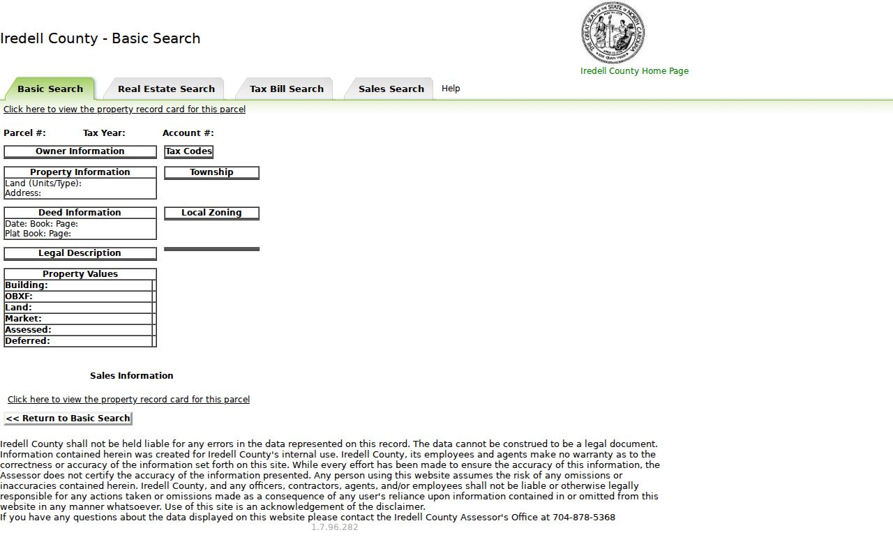
The Iredell County Tax Search is the practical entry point for an address. Its fields include owner name, account number, segmented parcel fields, tax year, house number, unit, direction, street name, type, suffix, municipality, legal land size, legal land type, and zoning. At least one field is required. The result can show owner information, parcel and tax details, township, deed references, legal description, property values, and sales information.
The Iredell parcel-card view illustrates the fields available after a parcel is selected.
Use a deed book or page as the next record key, not as proof that every current neighbor is identified. The tax portal says its display is not a legal document and the Assessor does not certify its accuracy. A deed image or office confirmation is the better route for a material ownership question.
Note: The owner field, mailing detail, and situs address can identify different roles on one parcel record.
Map a Statesville Neighbor Block
The county’s MapGeo provides the map layer for an adjacent-parcel review. The research did not capture stable click, buffer, radius, measure, or export controls, so do not assume a current one-click neighbor tool. Instead, use the address or parcel from Tax Search, pan or zoom along the street, and inspect neighboring polygons one at a time. County GIS layers include tax mapping, parcels, floodplain, zoning, fire, topography, election, address and street data, and ZIP information.
- Search the known address in Tax Search and write down the parcel or account number, current street spelling, and township.
- Open MapGeo, find the parcel, and review the surrounding polygons without assuming that every polygon is a dwelling.
- Open each relevant parcel card separately and label the record role shown there, such as owner display or deed reference.
- Use the Register of Deeds for a recorded interest, the City for a city service question, or historical sources for an earlier block.
This is a block method, not a whole-street census. For a longer current address chain, the Statesville Street Directory follows the street-record approach in more depth.
Statesville Neighbor Geographies
A nearby parcel can have a postal ZIP, township, precinct, ward, city-limit status, and street address at once. Those labels do not mean the same thing. The Iredell County Map Gallery supplies separate ZIP, city-limit, precinct, township, and Statesville ward maps. Use each map for its own public geography rather than treating a ZIP or mailing label as proof of municipal location.
MapGeo’s ZIP service exposes ZIP_CODE, CITY, STATE, geometry, and county GIS fields. It can return JSON or GeoJSON and has a maximum record count of 2,000, but a map-derived boundary still needs verification. A ZIP polygon is not a city limit, and a ward or precinct does not establish a person’s address. These distinctions matter when comparing parcels across a block edge.
- Situs address
- The physical property address shown in an assessor context. It can differ from an owner’s mailing address.
- Parcel geometry
- The mapped shape of a land record. It helps show proximity but is not a boundary survey.
- Precinct
- An election geography. It is not a private household directory.
Note: Verify a precise boundary or property line with the custodian or a qualified survey source, not only a public web map.
Statesville Neighbor History Layers
Historic sources can show how a block changed without claiming that a current roster existed in the past. The Iredell County Public Library map index identifies May 1900 Sanborn sheet 6, a 1908 bird’s-eye map, a 1920 City map, June and July 1930 Sanborn sheets, and index material for 1936 and 1941. The Library of Congress also holds a February 1885 Statesville Sanborn map. Sanborn maps show structures, mapped uses, streets, and physical change, not every occupant.
Pair a dated map with the nearest directory street section, newspaper, deed, or library house-history file. The directory can associate a printed name with a street in that volume, while the map may show whether the lot held a dwelling, store, school, church, workshop, or another use. Compare street spelling, block number, and date before treating two lines as the same place.
Statesville’s historic-district resources provide place context, too. The Garfield/Green Street area was listed on the National Register effective December 29, 2025, with formal notice February 26, 2026. That recognition describes documented places and history, not a resident roster.
Note: A Sanborn map can confirm a structure or use, but not every person connected with the address.
Statesville Civic Neighbor Context
No official citywide neighborhood-association or private member directory was located in the research. That gap matters. Public civic pages can help explain a block’s meeting, preservation, downtown, or service context, but they do not identify all people nearby. The following groups provide public-facing context rather than household lists.
| Public civic resource | What its published material supports | Access |
|---|---|---|
| Downtown Statesville Development Corporation | Main Street program, public downtown context, board and committees | City information; office at 300 S Center Street |
| Historic Preservation Committee | Preservation and place-based context | City boards and commissions page |
| African American Heritage Preservation Commission | Community and historical preservation context | City boards and commissions page |
The City’s boards and commissions page shows the public civic setting for these groups.
Downtown Statesville Development Corporation’s City page says its Main Street work dates to 1982, it is a 501(c)(3), and it has an 18-member board and committees. Those details describe an organization, not the people living on nearby parcels.
For a city code concern, use the Statesville code-violation route only after checking that the issue is within City jurisdiction. The form warns that communications may be subject to the Public Records Law.
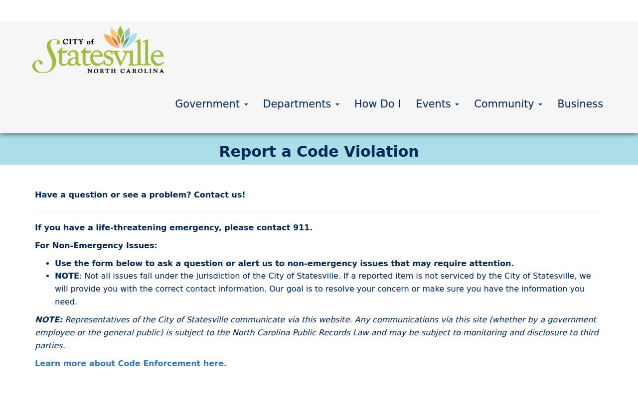
That route can document a municipal concern. It should not be used to assemble a private block profile or bypass another office’s record limits.
Compare Statesville Neighbor Results
Official records and commercial neighbor-search categories answer different questions. An official screen names its custodian and defines its record role. A commercial profile may combine public and licensed inputs, but it can carry stale matches, merged identities, or unclear source dates. When accuracy matters, return to the Iredell or North Carolina custodian and keep the source date.
| Official record route | Commercial neighbor-search category |
|---|---|
| Shows a defined public record role, such as parcel owner display or court party. | May combine records without a clear role or source date. |
| Provides an agency or custodian for correction and certification. | May not show which source controls a disputed detail. |
| Requires the reader to respect protected fields and legal limits. | Does not replace a custodian’s privacy or accuracy rules. |
For a deed, plat, or prior reference, use the Iredell County Register of Deeds / Land Records. Its online services are moving from Cott Systems to CCS, and the county says testing data may be incomplete or inaccurate. Check both systems when needed and verify a material result at the office.
Statesville Voter Data Boundaries
North Carolina voter law permits county or precinct lists and selective lists by fields such as party, gender, race, registration date, precinct, districts, and voter history under N.C.G.S. §163-82.10. The exact current request form, fee, delivery format, bulk-download option, and street-sorted file details were not located in the official sources reviewed. Do not promise a block-level voter list from the public name lookup.
The NC State Board of Elections Voter Lookup is name- and county-centered. It asks for first name, optional middle initial, last name, year of birth, county, and at least one status category. Results can display jurisdictions, polling place, sample ballot if available, absentee information, and voter history. Full or partial Social Security numbers, dates of birth, driver-license information, registration-agency identity, and signatures are protected.
Use a voter result as a dated civic-record lead, not a claim about present occupancy. The Iredell Board of Elections can explain the lawful public-list format and protected-field limits for a specific request.
Privacy Limits for a Statesville Neighbor
Private household members, protected residents, delivery data, utility customers, closed motor-vehicle address records, sealed court files, and confidential voter fields do not belong in a block lookup. North Carolina’s Address Confidentiality Program protects eligible victims and household members through a substitute address. A public name or map fragment must never be used to reveal that protected location.
Statesville records requests are governed by the North Carolina Public Records Act, but access is subject to redactions and specific exemptions. If an official record is wrong, ask the office that holds it to correct or explain it. Do not label a parcel owner as an occupant or turn a historic directory entry into a current contact record.
Lawful use. Use Statesville neighbor information for lawful personal research and block context. Stalking, harassment, intimidation, doxxing, or efforts to expose protected information are prohibited.